
North Carolina’s commitment to land and water protection is embodied in its erosion and sedimentation control program, guided by a comprehensive planning and design manual.
This manual details processes, principles, and vegetative considerations for effective erosion mitigation across the state, ensuring environmental stewardship.
Since 1973, North Carolina has proactively addressed soil erosion, establishing statewide regulations to safeguard its valuable natural resources for future generations.
Historical Context of Erosion Control in NC
North Carolina’s journey in erosion control began gaining significant momentum in the early 1970s, driven by increasing awareness of the detrimental impacts of sedimentation on waterways and ecosystems. Prior to 1973, control efforts were largely fragmented and lacked a unified statewide approach.
The escalating problems of soil loss, particularly related to construction and agricultural practices, prompted legislative action. This ultimately led to the landmark North Carolina Sedimentation Pollution Control Act of 1973. This act established a formal framework for addressing erosion and sedimentation, marking a pivotal shift in the state’s environmental policy.
The initial focus was on regulating land-disturbing activities, requiring permits and the implementation of best management practices (BMPs). Over the decades, the program evolved, incorporating advancements in scientific understanding and technological solutions, all documented within the evolving Erosion and Sediment Control Planning and Design Manual.
The North Carolina Sedimentation Pollution Control Act of 1973
The North Carolina Sedimentation Pollution Control Act of 1973 fundamentally reshaped land use practices across the state, establishing a comprehensive regulatory system to mitigate the harmful effects of erosion and sedimentation. This legislation mandated permitting for any land-disturbing activity exceeding a specified threshold, ensuring accountability for responsible land management.
Central to the Act was the creation of a statewide program designed to prevent the pollution of waters resulting from erosion and sedimentation. It empowered state and local agencies to develop and enforce control measures, guided by the principles outlined in the Erosion and Sediment Control Planning and Design Manual.
The Act’s provisions laid the groundwork for the development of detailed standards and specifications, promoting the adoption of Best Management Practices (BMPs) to minimize soil loss and protect water quality, establishing a lasting legacy of environmental protection.
Purpose and Scope of the Erosion Control Manual
The North Carolina Erosion and Sediment Control Planning and Design Manual serves as the cornerstone for implementing the Sedimentation Pollution Control Act of 1973. Its primary purpose is to provide clear, concise guidance for preventing and controlling erosion and sedimentation associated with land-disturbing activities throughout the state.
The manual’s scope encompasses a wide range of topics, from understanding erosion processes and selecting appropriate Best Management Practices (BMPs) to detailed design specifications and permitting requirements. It’s intended for use by engineers, developers, contractors, and local government officials.
Regular updates and revisions ensure the manual reflects the latest scientific knowledge and regulatory changes, maintaining its relevance and effectiveness in protecting North Carolina’s valuable water resources.

Understanding Erosion and Sedimentation Processes
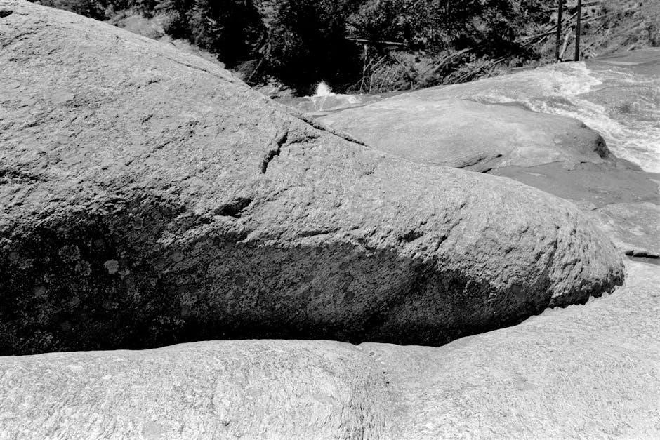
North Carolina’s manual details erosion types – sheet, rill, and gully – alongside factors influencing rates and sediment transport, crucial for effective control.
Types of Erosion (Sheet, Rill, Gully)
North Carolina’s Erosion and Sediment Control Planning and Design Manual meticulously defines three primary types of erosion impacting the state’s landscapes. Sheet erosion involves the uniform removal of soil in thin layers by surface runoff, often going unnoticed until significant damage occurs.
Rill erosion manifests as small, shallow channels formed by concentrated water flow, easily disrupted by tillage but indicative of worsening conditions. Finally, gully erosion represents the most severe form, creating deep, wide channels that cannot be easily removed, often requiring substantial engineering interventions.
Understanding these distinctions is paramount for selecting appropriate Best Management Practices (BMPs) and implementing targeted control measures, as outlined within the manual.
Factors Influencing Erosion Rates
The North Carolina Erosion and Sediment Control Planning and Design Manual emphasizes that erosion rates aren’t uniform; they’re dictated by a complex interplay of factors. Rainfall intensity and duration are critical, with heavier storms causing more significant soil detachment and transport.
Soil type plays a vital role, as sandy soils are more susceptible than clay-rich soils. Slope steepness and length directly impact runoff velocity and erosive power. Vegetative cover is a key mitigating factor, with robust plant life protecting soil from impact.
Finally, land use practices – construction, agriculture, forestry – profoundly influence erosion potential, necessitating tailored control strategies detailed in the manual.
Sediment Transport Mechanisms
The North Carolina Erosion and Sediment Control Planning and Design Manual details how detached soil particles are moved, outlining several key transport mechanisms. Sheet flow carries sediment as a thin layer across surfaces, while rill erosion creates small channels for concentrated flow.
More dramatically, gully erosion forms larger, deeper channels, transporting substantial sediment volumes. Suspension occurs when fine particles are carried within the water column, while saltation involves bouncing particles along the bed.
Finally, traction describes the rolling and sliding of larger sediment grains. Understanding these mechanisms is crucial for selecting appropriate Best Management Practices (BMPs) as outlined in the manual.

Regulatory Framework for Erosion Control in North Carolina
North Carolina enforces strict erosion and sediment control through state laws, local ordinances, and NCDOT certification, all detailed within the planning and design manual.
Permitting requirements and compliance are essential for all land-disturbing activities, ensuring adherence to established control regulations.
State Regulations and Permitting Requirements
North Carolina’s Sedimentation Pollution Control Act of 1973 forms the cornerstone of state regulations, requiring permits for any land-disturbing activity exceeding one acre.
The North Carolina Department of Environmental Quality (DEQ) oversees permit issuance and enforcement, utilizing the Erosion and Sediment Control Planning and Design Manual as its guiding document.
These permits mandate the implementation of Best Management Practices (BMPs) to minimize erosion and sediment runoff, protecting state waters from pollution.
The permitting process involves submitting detailed erosion and sediment control plans, demonstrating compliance with the manual’s standards and specifications.
Regular inspections are conducted to ensure proper BMP installation and maintenance, with penalties for non-compliance, reinforcing the state’s commitment to environmental protection.
Local Erosion Control Ordinances
While North Carolina establishes statewide erosion and sediment control regulations, local governments often enact more stringent ordinances tailored to specific regional challenges.
These local ordinances frequently supplement the state’s requirements, addressing unique topographical features, soil types, or sensitive environmental areas within their jurisdictions.
County and municipal governments may impose stricter BMP requirements, lower land disturbance thresholds, or additional inspection protocols to enhance erosion prevention.
Developers and construction professionals must navigate both state and local regulations, ensuring full compliance with the most protective standards applicable to their projects.
Consulting the North Carolina Erosion and Sediment Control Planning and Design Manual alongside local ordinances is crucial for successful project permitting and execution.
NCDOT Erosion and Sediment Control Certification
The North Carolina Department of Transportation (NCDOT) mandates Erosion and Sediment Control Certification for all personnel involved in land-disturbing activities on NCDOT projects.
This certification program, established in 2007, ensures that individuals possess the knowledge and skills necessary to implement effective erosion and sediment control practices.
Certification requirements typically involve completing approved training courses and passing a competency exam, demonstrating understanding of the North Carolina Erosion and Sediment Control Manual.
Certified professionals are responsible for developing and implementing Erosion and Sediment Control Plans (ESCPs), conducting inspections, and maintaining BMPs throughout project lifecycles.
Maintaining current certification is essential for continued involvement in NCDOT projects, reinforcing a commitment to environmental protection and regulatory compliance.

Best Management Practices (BMPs) for Erosion Control
North Carolina’s manual emphasizes both vegetative BMPs—like seeding and mulching—and structural approaches, such as silt fences and sediment traps, for effective control.
BMP selection considers whether implementation is temporary during construction or permanent for long-term site stabilization, as detailed in the manual.
Vegetative BMPs (Seeding, Mulching, Sodding)
North Carolina’s Erosion and Sediment Control Planning and Design Manual prioritizes vegetative practices as a first line of defense against soil loss. Seeding establishes quick cover, stabilizing disturbed areas and preventing rill erosion, while appropriate seed mixtures are crucial for success.
Mulching, utilizing materials like straw or wood chips, further protects the soil surface, reducing raindrop impact and conserving moisture—essential for seed germination. Sodding provides immediate, established vegetation, ideal for critical areas requiring instant stabilization, like channels or steep slopes.
The manual details specific application rates and timing for each technique, emphasizing the importance of selecting vegetation suited to the site’s soil type, climate, and intended use. Proper installation and maintenance are also highlighted to maximize the effectiveness of these BMPs.
Structural BMPs (Silt Fences, Sediment Traps, Check Dams)
The North Carolina Erosion and Sediment Control Planning and Design Manual outlines various structural Best Management Practices (BMPs) for situations where vegetative methods alone are insufficient. Silt fences act as barriers, trapping sediment carried by runoff and preventing it from entering waterways.
Sediment traps, often small basins, capture larger volumes of sediment, requiring periodic removal to maintain effectiveness. Check dams, small barriers built across drainage channels, slow water flow, reducing erosion and allowing sediment to settle.
The manual provides detailed specifications for the design, installation, and maintenance of these structures, emphasizing proper fabric selection, anchoring techniques, and regular inspection to ensure optimal performance and compliance with state regulations.
Temporary vs. Permanent BMPs
The North Carolina Erosion and Sediment Control Planning and Design Manual clearly differentiates between temporary and permanent Best Management Practices (BMPs), crucial for phased project implementation. Temporary BMPs are deployed during construction to immediately minimize erosion, like silt fences and sediment traps.
These are removed once permanent stabilization is achieved. Permanent BMPs, such as vegetated swales or retention ponds, provide long-term erosion control and stormwater management after construction concludes.
The manual stresses a sequential approach, transitioning from temporary to permanent measures as the project progresses, ensuring continuous protection of water quality and minimizing environmental impact throughout the project lifecycle.

Specific Erosion Control Challenges in North Carolina
North Carolina faces unique erosion challenges, from coastal losses on Hatteras Island to inland issues, demanding tailored solutions outlined in the state’s manual.
Construction activities and intensifying storms further complicate erosion control, requiring diligent planning and BMP implementation.
Coastal Erosion Issues (Hatteras Island, Outer Banks)
North Carolina’s Outer Banks, particularly Hatteras Island, experiences severe coastal erosion due to dynamic ocean forces and storm impacts. The North Carolina Erosion and Sediment Control Planning and Design Manual acknowledges these unique vulnerabilities.
Rapid land loss, exemplified by collapsing homes in Buxton, necessitates emergency interventions and long-term mitigation strategies. The manual guides the implementation of beach nourishment projects, dune stabilization techniques, and structural protections.
Dare County’s calls for state assistance highlight the urgency, and the manual provides a framework for assessing risks, obtaining permits, and deploying appropriate Best Management Practices (BMPs) to combat ongoing erosion and protect coastal communities.
Understanding sediment transport and wave dynamics, as detailed in the manual, is crucial for effective coastal erosion management.
Erosion in Piedmont and Mountain Regions
North Carolina’s Piedmont and Mountain regions face distinct erosion challenges, differing from coastal areas. Steep slopes, intense rainfall events, and varying soil types contribute to rill, gully, and sheet erosion. The North Carolina Erosion and Sediment Control Planning and Design Manual addresses these specific concerns.
Construction activities, forestry practices, and agricultural land use are primary drivers of sediment pollution in these regions. The manual emphasizes the importance of implementing vegetative BMPs like seeding and mulching.
Structural BMPs, such as check dams and sediment traps, are also crucial for controlling runoff and stabilizing disturbed areas. Proper planning and adherence to manual guidelines are essential for minimizing environmental impacts.
The manual provides detailed guidance on site assessment, BMP selection, and inspection procedures for these inland areas.
Erosion Related to Construction Activities
Construction sites represent a significant source of sediment pollution in North Carolina, demanding strict adherence to erosion and sediment control regulations. The North Carolina Erosion and Sediment Control Planning and Design Manual provides comprehensive guidance for mitigating these impacts.
The manual mandates the development and implementation of Erosion and Sediment Control Plans (ESCPs) tailored to each project’s unique characteristics. These plans must detail BMPs for minimizing soil disturbance and controlling runoff.
Commonly employed BMPs include silt fences, sediment traps, stabilized construction entrances, and temporary seeding. The manual emphasizes the importance of regular inspections and maintenance to ensure BMP effectiveness.
NCDOT certification is required for workers involved in erosion control on transportation projects, reinforcing the commitment to responsible construction practices.

Design Standards and Specifications
North Carolina’s manual features standard drawings and minimum standards dictated by the Sedimentation Pollution Control Act, often exceeding typical specifications.
These detailed guidelines ensure consistent, effective erosion and sediment control practices across all construction and land-disturbing activities statewide.
Standard Drawings for Erosion Control
North Carolina’s Erosion and Sediment Control Planning and Design Manual provides a robust collection of standard drawings crucial for implementing effective best management practices (BMPs).
These meticulously detailed illustrations depict proper installation techniques for various control measures, including silt fences, sediment traps, check dams, and diversions, ensuring clarity for field personnel.
Unless specifically modified by project requirements or local ordinances, adherence to these standard drawings is generally mandated, streamlining the design and approval processes.
The drawings are regularly updated to reflect advancements in erosion control technology and best practices, maintaining the state’s commitment to environmental protection and regulatory compliance.
They serve as a vital resource for engineers, contractors, and inspectors, promoting consistent and reliable erosion and sediment control throughout North Carolina.
Minimum Standards Established by the Act
The North Carolina Sedimentation Pollution Control Act of 1973 established foundational minimum standards for erosion and sediment control practices statewide, forming the bedrock of environmental protection.
These standards dictate requirements for land disturbance activities, emphasizing the necessity of minimizing soil loss and preventing sediment from entering surface waters.
Key provisions address site stabilization, runoff control, and the proper implementation of best management practices (BMPs) tailored to specific site conditions.
The Erosion and Sediment Control Planning and Design Manual expands upon these minimums, offering detailed guidance for achieving full compliance.
Adherence to these standards is legally mandated, ensuring responsible land development and safeguarding North Carolina’s valuable water resources for present and future generations.
Stringency Compared to Other Specifications
Generally, the specifications detailed within the North Carolina Erosion and Sediment Control Planning and Design Manual are considered more stringent than those found in many other states’ guidelines.
North Carolina’s approach emphasizes proactive prevention and comprehensive site management, demanding a higher level of detail in planning and implementation.
This heightened stringency reflects the state’s commitment to protecting its sensitive ecosystems, particularly its coastal areas and vital watersheds.
The manual often requires more robust BMP selection and implementation, alongside rigorous inspection and maintenance protocols.
Consequently, projects in North Carolina typically necessitate a more thorough and detailed erosion and sediment control plan to achieve regulatory approval;

Erosion Control Planning and Design Manual Details
North Carolina’s manual undergoes periodic updates and revisions to incorporate best practices and address evolving challenges in erosion and sediment control.
Key sections cover processes, vegetative measures, and structural BMPs, guiding project compliance with state control regulations.
Manual Updates and Revisions
North Carolina’s Erosion and Sediment Control Planning and Design Manual isn’t a static document; it’s a living resource, continually evolving to reflect advancements in scientific understanding, technological innovations, and lessons learned from practical application.
Regular updates are crucial for maintaining the manual’s relevance and effectiveness in addressing the dynamic challenges of erosion control. These revisions are driven by several factors, including changes in state and federal regulations, the introduction of new Best Management Practices (BMPs), and feedback from professionals actively involved in implementing erosion control measures across the state.
The North Carolina Department of Environmental Quality (DEQ) oversees the revision process, often incorporating input from stakeholders, including engineers, developers, and environmental consultants. Updates are typically released on a scheduled basis, ensuring that practitioners have access to the most current guidance available. Staying informed about these revisions is essential for ensuring project compliance and achieving optimal erosion and sediment control outcomes.
Key Sections of the Manual
The North Carolina Erosion and Sediment Control Planning and Design Manual is meticulously structured to provide comprehensive guidance. Core sections detail processes and principles of erosion and sedimentation, forming the foundational knowledge for effective control.
Significant portions are dedicated to vegetative considerations, outlining techniques like seeding, mulching, and sodding for stabilization. Further sections cover structural BMPs – silt fences, sediment traps, and check dams – offering detailed specifications for their design and implementation.
The manual also includes crucial information on preparing for and responding to storm events, alongside detailed standard drawings and minimum standards aligned with the North Carolina Sedimentation Pollution Control Act. These sections ensure practitioners have the tools needed for compliant and effective erosion management.
Utilizing the Manual for Project Compliance
Achieving project compliance in North Carolina necessitates diligent application of the Erosion and Sediment Control Planning and Design Manual. Practitioners must thoroughly understand the minimum standards established by the North Carolina Sedimentation Pollution Control Act, as detailed within the manual.
Proper implementation involves selecting appropriate Best Management Practices (BMPs) based on site-specific conditions, referencing the manual’s standard drawings for correct installation.
Regular updates and revisions to the manual require ongoing professional development to ensure adherence to the latest regulations. Successful compliance hinges on integrating the manual’s guidance throughout all phases of a project, from initial planning to final stabilization.
Erosion Control During and After Storm Events
North Carolina’s manual emphasizes preparedness for tropical depressions and hurricanes, detailing post-storm assessment, repair, and emergency control measures for effective mitigation.
Preparing for Tropical Depressions and Hurricanes
North Carolina’s Erosion and Sediment Control Planning and Design Manual stresses proactive preparation for storm events, particularly tropical depressions and hurricanes, which pose significant erosion risks.
Prior to anticipated storms, sites should undergo thorough inspections to ensure all Best Management Practices (BMPs) are functioning correctly and are adequately maintained. This includes verifying the integrity of silt fences, sediment traps, and check dams.
Critical areas identified as vulnerable to erosion should receive additional reinforcement. Stockpiles of sandbags, erosion control blankets, and other materials should be readily available for rapid deployment.
Furthermore, the manual recommends developing a detailed emergency action plan outlining procedures for protecting exposed soils and minimizing sediment runoff during and immediately following a storm event.
Post-Storm Erosion Assessment and Repair
The North Carolina Erosion and Sediment Control Planning and Design Manual emphasizes the critical need for immediate post-storm assessments to identify and address erosion damage. Following a storm, a comprehensive site inspection is paramount.
This assessment should document the extent of erosion, damage to BMPs, and any evidence of sediment deposition. Photographic documentation is highly recommended for record-keeping and potential insurance claims.
Repair efforts should prioritize stabilizing eroded areas and restoring the functionality of damaged BMPs. This may involve re-seeding, replacing silt fences, or repairing check dams.
The manual stresses prompt action to prevent further erosion and minimize the transport of sediment to waterways, safeguarding water quality and protecting downstream resources.
Emergency Erosion Control Measures
The North Carolina Erosion and Sediment Control Planning and Design Manual recognizes that rapid response is crucial during and immediately after severe weather events. Emergency measures focus on minimizing immediate damage and preventing widespread sediment pollution.
These measures may include temporary sediment barriers constructed from readily available materials like sandbags or straw bales, and the quick deployment of diversions to redirect stormwater flow.
Stabilizing severely eroded areas with geotextiles or temporary vegetation is also vital. The manual emphasizes prioritizing actions that protect critical areas and waterways.
Remember, these are temporary solutions; a comprehensive assessment and permanent repairs, following the manual’s guidelines, are essential once conditions allow.